04 August 2021
Australian Tree Crop Map Dashboard wins gold on world stage
Australian Tree Crop Map Dashboard wins gold on world stage
4 August 2021
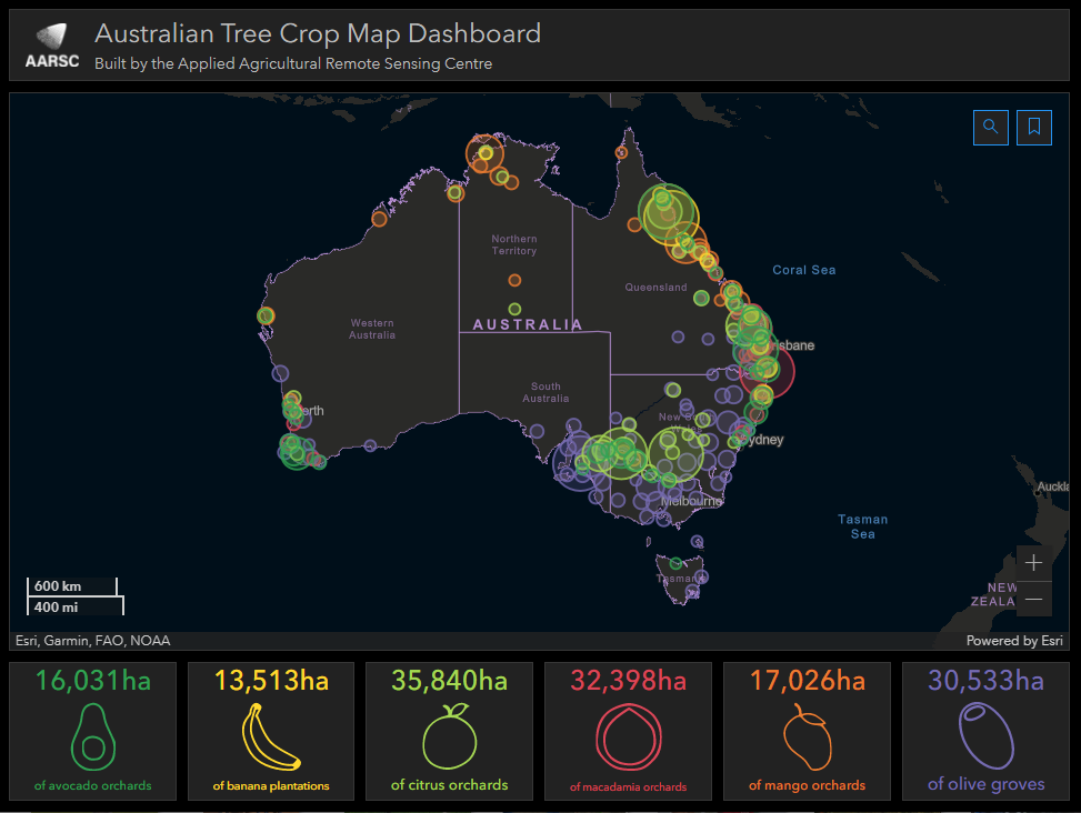
Australian Tree Crop Map Dashboard
The Australian Tree Crop Map Dashboard has won first place at the 2021 Esri User Conference – the world’s largest event dedicated to geographic information system (GIS) technology.
The ATCM Dashboard was developed by Craig Shephard and Joel McKechnie, researchers from the University of New England’s Applied Agricultural Remote Sensing Centre.
The Esri UC dates back to 1981 and is held in the United States every July at the San Diego Convention Centre in San Diego, California. 550,000 delegates attending this year’s event.
“We’re showing the world that the research tools and applications we’re producing here in Australia is of the highest standard,” Craig said.
“This really is a career highlight for Joel and I, having our work recognised at Esri US is the pinnacle. It puts our research centre AARSC and UNE on the map, so to speak.”
Craig and Joel started developing the ATCM Dashboard in 2020, as part of the Multi-scale Monitoring Tools for Managing Australian Tree Crops: Phase 2 research project.
This research is driven by the support of Hort Innovation and these six Australian industries: avocado, citrus, macadamia, mango, banana and olive.
The ATCM Dashboard was developed in response to the industry’s needs to better understand the extent (area and location of production) of their commercial operations >1ha.
The tool is freely available and interactively summarises the extent of avocado, citrus, macadamia and mango orchards, banana plantations and olive groves, and supports these industries to make informed and timely decisions around biosecurity and natural disaster responses.
The long-term vision for UNE’s Applied Agricultural Remote Sensing Centre is to establish Australian agriculture as a global leader in the adoption and utilisation of spatial technologies.
Whilst the development of the ATCM Dashboard provides the participating industries with an immediate tool for better understanding industry extent (area and location of production) and improved preparedness to biosecurity threats and natural disasters, the full potential is yet to come.
This essential base layer of data will ultimately support decision making processes related to traceability, resource management and yield forecasting as well as major national initiatives such as water security, soil health and carbon storage.
All applications developed by Craig Shephard and Joel McKechnie as part of Multi-scale Monitoring Tools for Managing Australian Tree Crops: Phase 2 can been viewed here: www.une.edu.au/webapps
Multi-scale Monitoring Tools for Managing Australian Tree Crops: Phase 2 is a part of the Rural R&D for profit scheme. This project is being funded by Hort Innovation using the citrus industry levy. Hort Innovation is the grower-owned not-for-profit research and development corporation for Australian horticulture. Professor Andrew Robson the Director of the Applied Agricultural Remote Sensing Centre is the project lead with Craig Shephard and Joel McKechnie managing the mapping component and outputs of this research.
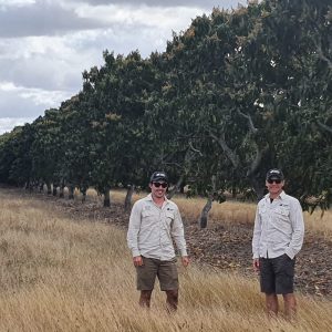
Joel McKechnie and Craig Shephard
Membership
You are not logged in
If you are not already a member, please show your support and join Citrus Australia today. Collectively we can make big things happen.